Property Record
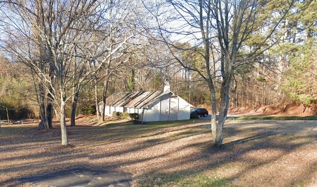
1834 Buford Dr, Lawrenceville, GA 30043


Property Detail
1834 Buford Dr
7-090-015
STATE HWY 20
Religious
Gwinnett
R100
Georgia
B and X Area of moderate flood hazard, usually the area between the limits of the 100-year and 500-year floods.
9.61 AC
2025
Duluth/Suwanee/Buford
2025
Atlanta
050572
Atlanta-Sandy Springs-Roswell, GA
2,448 SF
NEARBY LISTINGS FOR SALE OR LEASE
-
-
View all Lawrenceville listings for sale on LoopNet.com
DEMOGRAPHICS near 1834 Buford Dr
1 mile
3 mile
5 mile
2025 Total Population
8,285
65,712
184,321
2030 Population
8,710
68,887
193,192
Pop Growth 2025-2030
+ 5.13%
+ 4.83%
+ 4.81%
Average Age
39
39
38
2025 Total Households
2,601
21,696
60,138
HH Growth 2025-2030
+ 5.27%
+ 5.10%
+ 5.01%
Median Household Inc
$115,798
$97,814
$93,060
Avg Household Size
3.20
2.90
3.00
2025 Avg HH Vehicles
3.00
2.00
2.00
Median Home Value
$398,369
$398,814
$404,675
Median Year Built
1994
1996
1998
Nearby Places
Map Layers
Map Styles
 Street
 Aerial
Transit
 Traffic
 Biking
Places
Listings with unknown addresses are not visible on the map
- Restaurants
- Banks
- Shops
- Fitness
- Groceries
Nearby Properties
Address
Land Use
TOTAL SIZE
Lot Size
Zoning
Address
Land Use
TOTAL SIZE
Lot Size
Zoning
1,071,116 SF
69.77 AC
OI
Address
Land Use
TOTAL SIZE
Lot Size
Zoning
939,709 SF
159.36 AC
RS180
Address
Land Use
TOTAL SIZE
Lot Size
Zoning
563,718 SF
41.75 AC
RM13
Address
Land Use
TOTAL SIZE
Lot Size
Zoning
455,605 SF
33.93 AC
RM13
Address
Land Use
TOTAL SIZE
Lot Size
Zoning
415,963 SF
48.86 AC
RM10
Address
Land Use
TOTAL SIZE
Lot Size
Zoning
461,593 SF
14.11 AC
MUR
Address
Land Use
TOTAL SIZE
Lot Size
Zoning
394,831 SF
16.37 AC
RM24
Address
Land Use
TOTAL SIZE
Lot Size
Zoning
415,609 SF
16.50 AC
RM24
Address
Land Use
TOTAL SIZE
Lot Size
Zoning
439,272 SF
18 AC
RM24
Address
Land Use
TOTAL SIZE
Lot Size
Zoning
379,178 SF
39.27 AC
RM10
Address
Land Use
TOTAL SIZE
Lot Size
Zoning
367,419 SF
17.06 AC
RM24
Address
Land Use
TOTAL SIZE
Lot Size
Zoning
439,723 SF
64.56 AC
R100
Address
Land Use
TOTAL SIZE
Lot Size
Zoning
282,431 SF
23.20 AC
RM13
Address
Land Use
TOTAL SIZE
Lot Size
Zoning
282,630 SF
11.83 AC
MUO
Address
Land Use
TOTAL SIZE
Lot Size
Zoning
514,956 SF
47.21 AC
M1
Address
Land Use
TOTAL SIZE
Lot Size
Zoning
102,152 SF
20.95 AC
C2
Address
Land Use
TOTAL SIZE
Lot Size
Zoning
218,583 SF
2.21 AC
MUO
Address
Land Use
TOTAL SIZE
Lot Size
Zoning
223,096 SF
6.06 AC
MUR
Address
Land Use
TOTAL SIZE
Lot Size
Zoning
93,022 SF
68.90 AC
R100
Address
Land Use
TOTAL SIZE
Lot Size
Zoning
661,663 SF
50.64 AC
M1
Address
Land Use
TOTAL SIZE
Lot Size
Zoning
457,110 SF
22.37 AC
M1
Address
Land Use
TOTAL SIZE
Lot Size
Zoning
159,547 SF
24.72 AC
R100
Address
Land Use
TOTAL SIZE
Lot Size
Zoning
6,031 SF
120.86 AC
OI
Address
Land Use
TOTAL SIZE
Lot Size
Zoning
597,445 SF
39 AC
M1
Address
Land Use
TOTAL SIZE
Lot Size
Zoning
212,293 SF
2.89 AC
MUR
Address
Land Use
TOTAL SIZE
Lot Size
Zoning
595,760 SF
39.11 AC
M1
Address
Land Use
TOTAL SIZE
Lot Size
Zoning
541,840 SF
29.37 AC
M1
Address
Land Use
TOTAL SIZE
Lot Size
Zoning
310,168 SF
46.14 AC
R75
Address
Land Use
TOTAL SIZE
Lot Size
Zoning
469,470 SF
29.68 AC
M1
Address
Land Use
TOTAL SIZE
Lot Size
Zoning
212,571 SF
31.30 AC
RA200
The World's #1 Commercial Real Estate Marketplace
Connect with us
© 2026 CoStar Group
The information above has been obtained from sources believed reliable. While we do not doubt its accuracy we have not verified it and make no guarantee, warranty or representation about it. It is your responsibility to independently confirm its accuracy and completeness. Any projections, opinions, assumptions, or estimates used are for example only and do not represent the current or future performance of the property. The value of this transaction to you depends on tax and other factors which should be evaluated by your tax, financial, and legal advisors. You and your advisors should conduct a careful, independent investigation of the property to determine to your satisfaction the suitability of the property for your needs.